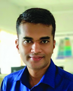
Dr. Sajeesh Viswambharan

Name of  Faculty Dr. Sajeesh Viswambharan
Phone Number
Blood Group  O+ve
Address for Communication Viswasree, Melpadam,
Nanniode (PO)
Palakkad, Kerala – 678534
E-mail ID vsajee@gmail.com
Qualification M.A, Diploma in Geo- Information Technology, P.G Diploma in Geomatics, Ph.D
Area of Specialization Urban Geography & GIS and Remote Sensing Applications, Aerial Triangulation, Orthophoto generation and Mosaicing – Aerial photographs & High resolution Satellite images includes Quick Bird, GeoEye and World view ,Orthophoto generation using Lidar technology – Terra photo module.
NET/SET/GATE/KSLET  qualified Nil
Teaching Experience 5 Years
Courses Handled M.Sc, B.Sc
Languages Known Malayalam, English
Area of interest (Other than studies) Nil


Dr Sajeesh Viswambharan
Dr. Sajeesh Viswambharan
Assistant Professor
  • Spatio-temporal analysis of in-fill and non-infill built-up growth of Chamarajanagara Town, Published in Thematic Journal of Geography – UGC-Care Approved, ISSN: 2277-2995, Impact factor: 5.255
  • Push and Pull factors of urban growth; A Case study of Nanjangud town, Published in International Journal of Research and Analytical Reviews – UGC Approved, ISSN: 2349-5138, Impact factor: 5.75
  • Prediction of Urban Growth in Chamarajanagara region Using Geospatial Techniques, Published in Journal of Emerging Technologies and Innovative Research – UGC Approved, ISSN:2349-5162, Impact factor: 5.87
  • Spatio-Temporal Analysis of In-fill and Out-fill Built-up growth of Nanjangud Town, Published in Journal of Emerging Technologies and Innovative Research – UGC Approved, ISSN:2349-5162, Impact factor: 5.87
  • Attended National Seminar on Land use /Land cover changes and its impact: Spatial Challenge and Geospatial Technologies. February 19th & 20th 2015 (ICCSR & Madurai Kamaraj University)
  • Attended Indian Science Congress- January 03 to 07, 2016, University of Mysore, Mysore.
  • Attended and presented a paper in Indian Social Science Congress, DOS in Geography, Univerrsity of Mysore – December 19 – 23, 2016
  • Attended National Seminar on Tourism, Environment and Sustainable Develoment. Kannur University, Department of Geography – 2018
  • Paper Presentation on National Seminar at Department of Geography, Kannur University- 2018
  • Aerial Triangulation/Ortho rectification of Aerial & Satellite images. Unmanned Aerial Vehicle (UAV) image Processing. Orthophoto generation using Lidar technology.
  • Defense and Home Land Security Applications of GIS & Remote Sensing in Border Security Force (BSF). – Various GIS mapping, 3D data generation and modeling.
  • Providing in and onsite house front end support to the client
  • Create & maintain multiple geospatial databases for storage of large volumes of geographic information.
  • Providing Hardware and Software solutions for Border Security Force (BSF).
  • Defense and Security Applications of GIS and Remote Sensing for Officers and Subordinate Officers. (FTR HQ Jodhpur Rajasthan, FTR HQ Kashmir, FTR HQ Tripura Agarthala, FTR HQ Jalandhar Punjab, FTR HQ Jammu).
  • Attended PCI Geomatica Professional Course in PCI Software Pvt. Ltd, Bangalore.
  • Professional Training from SuperGeo Tech,Taiwan
    • Super GIS Desktop with Extensions
    • Server GIS:- Super Web GIS, Super GIS Server
    • Mobile GIS:- Scepter- Mobile GIS Pro: comprising of Window mobile, GPS, Camera and Super Pad mapping software.

Research and Development Committee Member, Class Mentor, Criteria 4 Member.

ADMISSION ENQUIRY